
We checked out of the hotel early, then got a quick breakfast at McDonalds in Alice. We opted for the fast food because it cost AU$8.00 instead of AU$36.00 as charged by the hotel. We were also getting just a bit tired of cereal and fruit every day. A nice, greasy egg McMuffin and hash browns were just what we needed. As a bonus, we got to see a cute little McDonalds car in the car park at the restaurant. We were done and on Stuart highway headed south by 7:40am. The signpost said we’d be at Uluru in 441km.
There were high clouds over Alice, but we could see an edge to the cloud cover a little ways south. Before long we were driving in bright sunshine. About ten kilometers out of Alice we again saw the strange signs by the road — an empty circle with a line through it. Chris looked in the Lonely Planet guide to see if there was any mention of these signs. They weren’t mentioned directly, but the guide did say that on paved roads in the Northern Territory outside of towns, there is no speed limit. That must be what the signs mean. I sped up and leveled off at 130 kph (about 80 mph). By this time I was feeling very comfortable in the left lane.
At 9:30 we came to the first petrol station. We didn’t need much, but I topped off the tank, we took advantage of the toilets, and we were off again. As we drove, Chris continued to read aloud from the Lonely Planet guide’s chapter on Australia as a whole. We learned more about the art, plants, animals, music, and history of Australia. The landscape stayed green and we even saw occasional pools of water and actual running creeks.
We finally left Stuart Highway — which runs from Adelaide to Darwin — at Erlunda. There we filled up with petrol again — at outrageous prices. As I pulled up to the highway entrance on leaving Erlunda, I was reminded about the necessity of looking to the right before turning right in Australia. I had come to a stop close to the road, instinctively looked left before turning right, and was about to look right when a “road train” roared by less than ten feet in front of the car. A road train is a tandem tractor trailor that pulls three trailors instead of the normal one or two. They are huge, and I’ll bet they can’t stop very quickly.
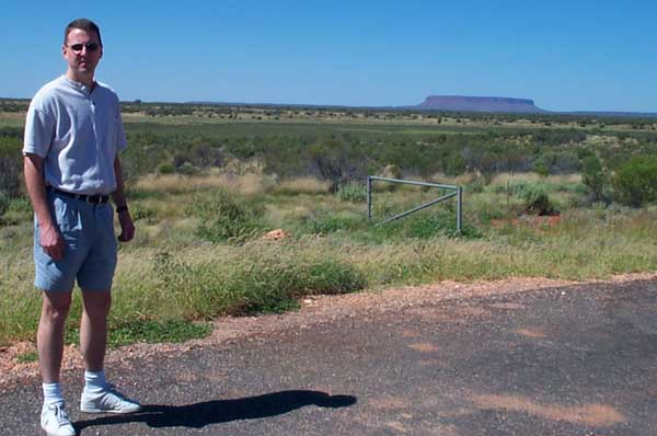
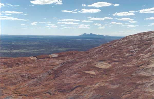
At 10:45, still 244km from Ayers Rock Resort, we stopped at a view point that looked out over the plain to Conner Mountain, a very large, flat mountain ‘way off in the distance. We also passed several drying cow carcasses, the apparent victims of collisions with cars.

Our next stop was a place called Curtin Springs, where we didn’t get petrol, but we once again took advantage of the toilet facilities. The most memorable feature of Curtin Springs was a fenced area about ten feet by twenty feet that was about eight feet high and covered. Inside were half a dozen Guinea pigs.
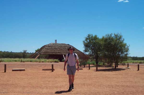
We arrived at Ayers Rock Resort exactly four hours after leaving Alice Springs having averaged 110kph (almost 70mph), including stops. All without ever exceeding the speed limit. We quickly checked in and took our bags to our room. Unlike our other accommodations, the room entrance at this resort is from the outside. There are a number of small buildings, each with four rooms. Each room has a sliding door that leads to a ground-level patio. Our patio was on the edge of a lawn next to the pool.
I called to make dinner reservations for that night and the next, and to book a motorcycle tour of the rock at sunrise the next morning. By the time we had settled the bags in the room and made our reservations, our gourmet breakfast had worn off. We had a quick, light lunch in the hotel restaurant, then drove the ten kilometers to Uluru-Kata Tjuta Park.
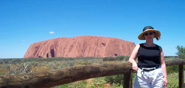
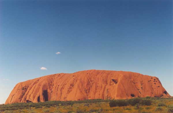
Uluru is prounounced OO’-luh-roo. Kata Tjuta is pronounced KA’-tuh JOO’-tuh. Uluru is the Aboriginal name of the large rock known also as “Ayers Rock”. Kata Tjuta, meaning “many heads,” is the Aboriginal name of a group of rock outcroppings also known as “The Olgas”. When the land that contains these two rock formations was returned to the Aboriginees, the original names were restored, though many people still refer to them by their western names. Both Uluru and Kata Tjuta are impressive formations, visible from many miles away. Uluru is 1,000 feet high and 1/2 mile long. The highest part of Kata Tjuta is nearly 1,500 feet high.
We first went to Uluru. There are a number of walking trails there, but we wanted to climb the rock. The Aboriginal owners would prefer that people not climb onto Uluru, but they make it pretty easy to do so, and 400,000 people climb up every year. We got to the beginning of the climb about 2:00, not quite the hottest part of the day, but hot nonetheless.
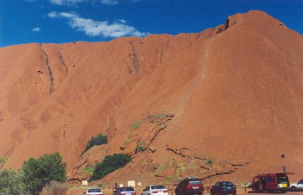
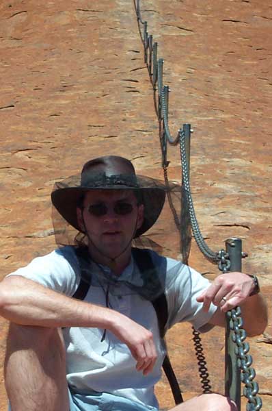
The temperature was in the 80’s, but the humidity was low and there were nice breezes. We took four liters of water with us and headed up the rock. About fifty yards up the rock there is a chain that helps you climb. Parts are so steep that we wouldn’t have attempted them without the security of the chain. Other parts are easier, but it’s nice to have the chain there, especially coming down.

We took frequent breaks going up, catching our breath about every fifty feet and taking a drink of water every three or four breathers. We met several groups of people coming down. All of them said that the climb was worth it. A couple of them stopped to chat while we caught our breath. We met two young men who had just graduated college in Canada and were spending a year in Australia and Asia while they decided what to do with their lives. We were passed by a man from Austria who said “We climb all the time, there.” He didn’t seem to be particularly tired as he climbed past us.
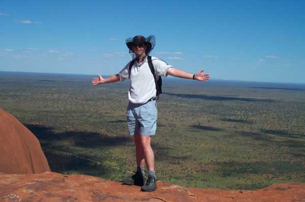
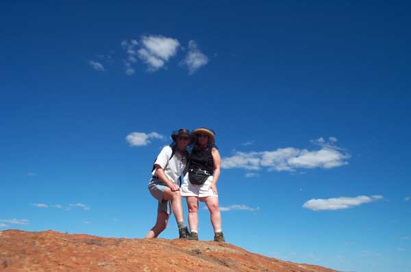
After about an hour, we reached the top of the chain. We stopped to catch our breath and take a picture or two.

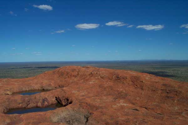
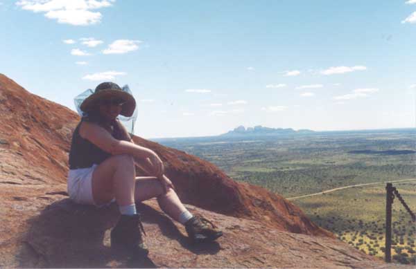
Everyone we had talked to said that once we were there, the hard part was over. Even at this height, the view was wonderful. Uluru looked like a bunch of sand dunes from many places along the route. We continued up, on the “easy” part.
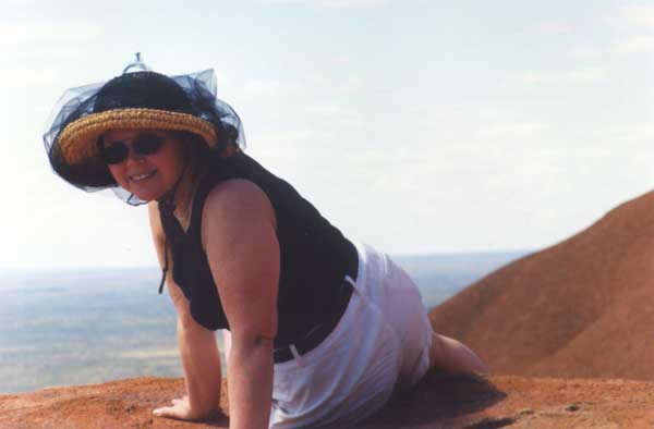
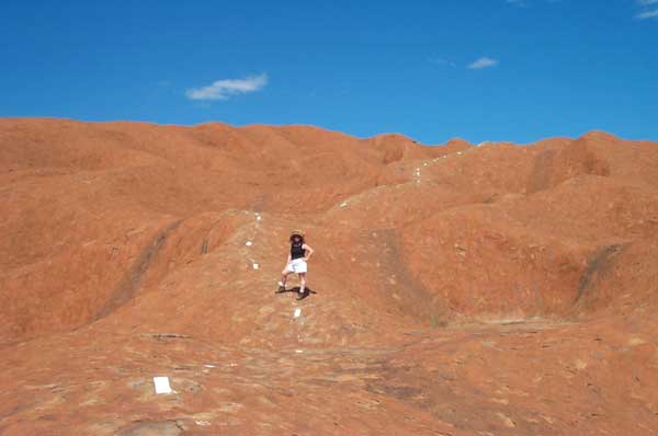
Since there was no chain to show the way, some kind person had painted white stripes about a foot long and four inches wide every eight or ten feet. At one point, we could see this dotted line extending along a curving ridge line as far as we could see. I felt like I was in a Dr. Seuss landscape. Just this red rock and this dotted line going to the edge of the world.
There was still a lot of climbing. We finally came to a point where we could see the landscape on the other side of the rock. Mostly it wasn’t as steep as before, and there were even some places where it went down. One of those was quite difficult, because it was pretty steep, and, if you slipped and fell to the right, there was nothing to stop you from falling seven hundred feet to the bottom.
That was the scariest part. A few minutes later we met three people coming down. We had been climbing for nearly two hours, and they said we were still twenty minutes from the end. We had thought we were a lot closer. Disheartened, we continued. Around the next bend, we saw the dotted line leading us through a series of dips and hills, with the end still out of sight. We decided we had come far enough and headed back.
The trip down was much quicker, but pretty tough on our knees and ankles. Going downhill on uneven, unyielding rock really pounds on your leg joints. When we got to the chain, we kept going, walking backwards on the steeper portions to spare our knees and backs. Then we got to the bottom of the chain. We hadn’t noticed how steep the part below the chain was on our way up. It’s steep. We both crabbed down the rock, sometimes sitting down and scooting forward just to stay in control of our rate of descent.

Finally, we were back on the walk-able part of the rock, and soon back into the car park at the bottom. The trek had taken us three and a half hours, even though we hadn’t made it all the way. We were out of water, tired, and sore. We refilled our water bottles, rested a while, and then drove back to the hotel.
There was a pool back at the hotel. In no time we had changed into our swim suits and were testing the water with our toes. We had expected the pool to be pretty warm, given the air temperature, but it was refreshingly cool, about 75F. After a couple of laps, we weren’t hot any more. We got out, claimed some loungers, and sat back to rest. After about half an hour, I had had enough sitting around and headed back to the room to shower up. Chris came back in as I was getting dressed, then she showered and we both got ready for dinner.
Ayers Rock Resort has the only accommodations for the Uluru-Kata Tjuta park. They have three different levels of hotel: Sails in the Desert, the highest priced one; Desert Garden, mid priced; and Pioneer Lodge, budget priced. Each hotel has a restaurant that fits with the price of the rooms. We were staying at the Desert Garden, but our reservations for that evening were at the Kuniya restaurant, at Sails in the Desert. The meal, the atmosphere, and the service were all superb.
As we returned to the car for the short drive back to the Desert Garden, I looked up at the sky. The stars were amazingly bright — brighter than I can ever remember seeing them. We decided to get away from the street lights around the hotel complex to get a really good view of the stars, so we drove out to the main road, then towards the park about half a mile. We pulled off the road and just looked at the stars for a while. The Milky Way isn’t visible from San Jose, but it was plainly visible in the clear sky of Central Australia that night. After contemplating the immensity of it all, we drove back to our hotel. We had an appointment with a couple of bikies before dawn.